

Her fieldwork takes geologist Fiorenza Deon to remote areas in Indonesia and it wasn’t long before she learned the language, a skill she needs to be able to negotiate with the local authorities. Her geologic research forms part of GEOCAP, an international collaboration between the governments of Indonesia and the Netherlands, companies and universities aimed at exploring the use of geothermal energy. But GEOCAP is about more than just scientific research, underlines Deon. “Bilateral cooperation offers huge advantages to all parties.”
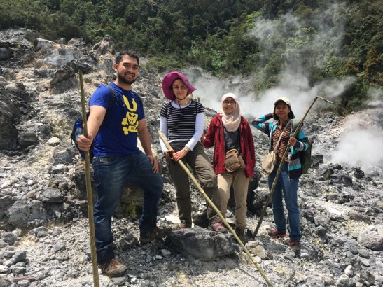
Tulus Imaro (master student TUD), Fiorenza Deon (TUD), Famelia Nurlaela (PhD candidate ITB) and Astiasari (PhD candidate UT-UGM). The field purpose was to collect samples for the geomechanical experiments to be performed at TUD. Photo by Tulus Imaro
The main aim of this research programme, which consists of several projects, is to develop and improve the production of geothermal power, using the heat from the earth to generate electricity. For Indonesia, a country dominated by volcanoes, it’s a renewable energy source that holds enormous potential. The research team, which is made up of Deon, prof. David Bruhn and dr. Auke Barnhoorn, focuses on the properties of the reservoir rocks suitable for geothermal purposes. “Our goal is to improve the characterisation of reservoir rocks,” Deon explains. “For that we need a better understanding of the subsurface. By studying rocks and surface water we will eventually be able to determine which areas are suitable for building geothermal plants.”
Deon is collecting rock and water samples in different areas on several Indonesian islands, including Java and Sumatra. Sulawesi will soon follow. “We take samples in remote areas about which we have very little data, and in areas where geothermal plants are already in operation. Indonesia lacks a general overview of the petrology and geochemistry of rocks and groundwater. Rock formations in particular are a terra incognita, and Indonesia is such a big country!”
Mapping areas in this way can determine whether drilling for geothermal energy is worth the effort, which will help Indonesia cut costs, Deon explains. “Seismic and geophysical exploration are often the chosen options but they come at a hefty price. Mapping an area first helps to make an informed decision about whether or not an area has the potential for geothermal energy. That’s why, after the research has been completed, I’d like to develop a best practice guide on how to chart different areas.”
Knowledge transfer
GEOCAP involves much more than just the pursuit of data, stresses Deon. The cooperation between the different partners and knowledge transfer form an integral part of the project. Deon: “Cooperation is better than going it alone. The focus of the project is on increasing the electric power supply in Indonesia while reducing the production of CO2. It’s impossible to do this without help. Bilateral cooperation offers huge advantages to all parties involved. In today’s world cooperation is key.”
To promote this knowledge transfer the team provides trainings and workshops at the Bandung Institute of Technology, one of the universities the team works with. “The aim of the capacity building programme is to train people and familiarise them with different research techniques. That’s something we also learn from: we have adapted our teaching methods as a result of teaching a varied audience, including people from industry or the government, with or without an academic background. I always enjoy being asked questions I don’t have an answer to straight away. It gives me the feedback I need to improve my classes. I try to combine teaching with field activities whenever possible so I can show students how to take samples, for instance. After all, that too is knowledge transfer.”
More than science
As a result of her many weeks of fieldwork in Indonesia, Deon, who is of Italian origin, has become quite proficient in Bahasa, Indonesia’s official language. ‘’If you want to do research in Indonesia there really is no other way, she explains. “You simply don’t get far by relying on English alone. You need to take time to talk to the local authorities, visit the local villages and meet the various landowners.’
For Deon, working in Indonesia is more than just a research job. The cultural aspect is deeply important to her. “I have become used to using my hands when eating, for instance. It’s a way of showing you appreciate the food. It is important to know about these traditions and to understand the mentality and the language of the country.”
Working with the Indonesian people is an important part of Deon’s personal motivation. “To think that my work can make a difference to these people’s living conditions, and provide them with sustainably generated electricity at some point in the future is a huge boost.’’
Source: TU Delft Stories of Sciences


